


According to the little known author Codman Parkerson, New Orleans has always been a well defended city: “For nearly all of the first two hundred years of its existence – 1717 to 1917 – New Orleans was America’s most fortified city. Strategically located near the mouth of the Mississippi River, New Orleans was the gateway to the interior of North America. Any invasion force would recognize this fact; any sovereign would as well.” Indeed, Parkerson goes on to list no less than 56 positions of defense built for the single purpose of protecting the river and the Crescent City that has sprawled along its shores.
I must admit, I’ve always been something of a history nerd; sure the subject isn’t to everybody’s liking, but when combined with a day of PWCing, I couldn’t help but offer the report. Opening with a quote from Parkerson’s book wasn’t by accident either – I’ve been reading it like a roadmap for months now. While the trip was definitely about the viewing of these antiquated bases, I’ll leave the history lessons to the links which reach out to my blog on the same subject. So, with that in mind, come join my friends and I for a 67 mile PWC cruise that will cover two major wars, attack and occupation by an invading enemy, and five locations of military construction designed to protect New Orleans. Let’s ride:
We were a small armada: a diverse fleet of six skis made up by one pair each of matching ‘Doos, Yammies, and Hondas. We departed the Chef Harbor Marina at 11:30 AM with our first stop being less than a mile away…
Fort Macomb (1820) lies on the southwest of Chef Pass near the Gulf Intracoastal Waterway (GIWW). Like all of the forts we’d visit today, Fort Macomb was part of the post-War of 1812 “Third System” coastal defense plan. While Macomb is still connected by land adjacent to Hwy 90, the entrance, as well as the fort, has been sealed off from the public. A view of any measure has to be taken by water. We idled around the moat, getting as close as the grass would let us, trying to get a peek through the barred gun ports to the inner-fort. Unfortunately, the lower portion of the forts outer wall is eroding in the water, while the tops are crumbling under the strain of the plant life that have taken hold of there.
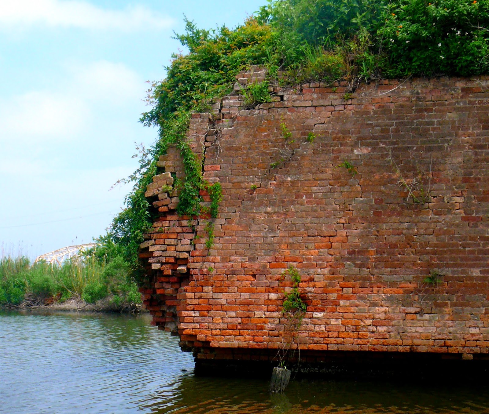
With no exploring to be done off the skis, we regrouped and headed southwest to our next target. Skirting the shore of Lake Borgne, we enjoyed three miles of calm waters before we exited the lake into Bayou Bienvenue. Then, a mile further, we found a most impressive brick wall standing in the marsh. The wall, of course, is the main structure still remaining of…
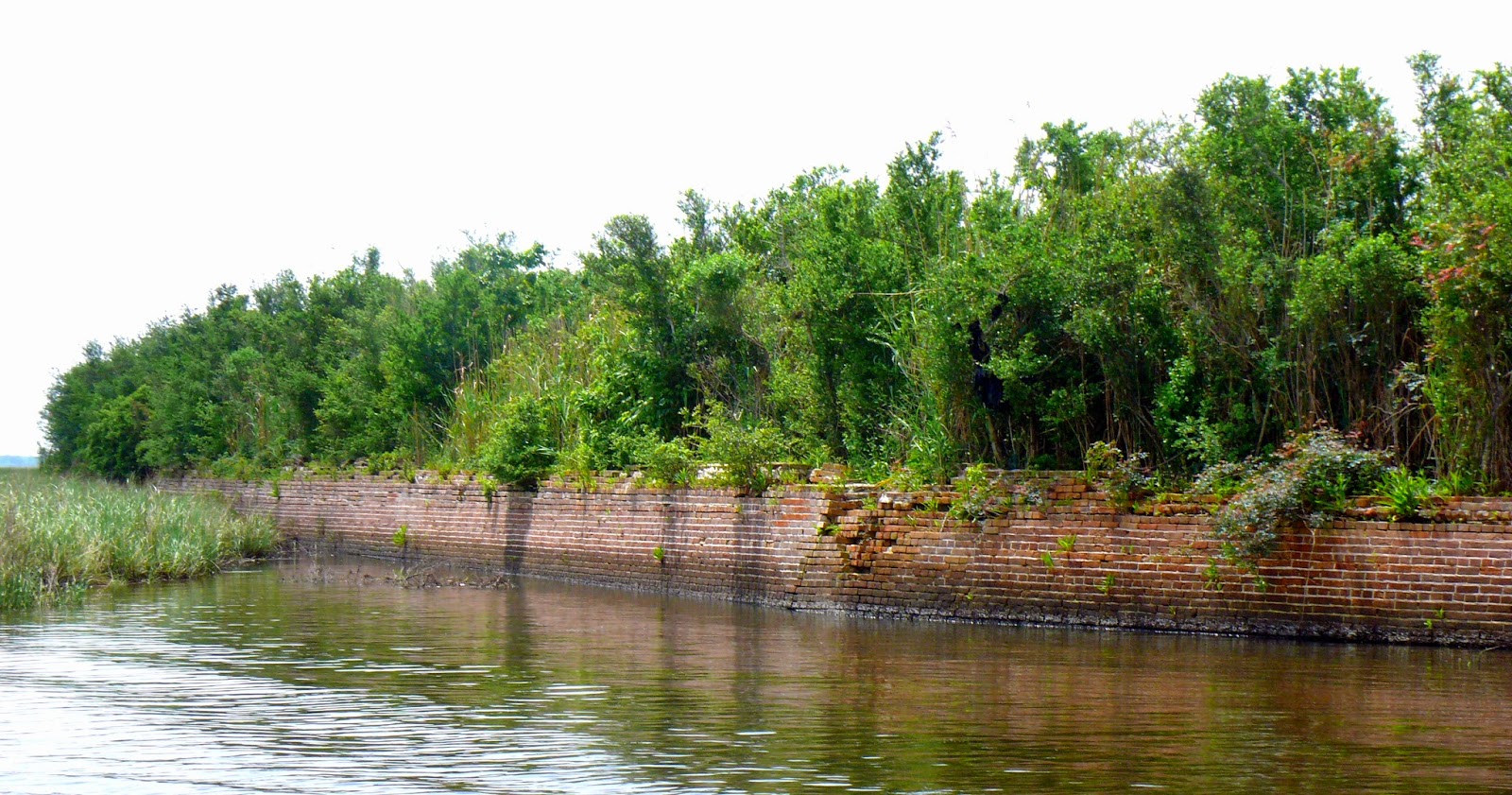
Battery Bienvenue (1828) is surrounded by water and tall marsh grasses, this is the only site in the NOLA vicinity still reported to have retained a few of its guns – we did not go look for them. “Bienvenue” is French for “welcome”, and I’m sure the Americans were intent on welcoming any invaders with a heavy barrage of cannon. Indeed, the site was chosen as this was on the same route taken by the British during their failed invasion of New Orleans during the War of 1812. While the nearly 500 foot long outer peremiter still stands, most of the rest of the base is gone.
With the wall behind us, we jaunted six wide down the Mississippi River Gulf Outlet (MRGO – pronounced Mr. Go) towards our next target. At one time the MRGO, was a major shipping channel – plenty deep and a quarter of a mile wide. The canal was ultimately deemed the culprit for letting most of Katrina’s surge in (and flooding the city) and the channel has since been dammed (and damned…). Cruising down the large canal, the right bank is topped by an impressive concrete wall. The wall, now reaching nearly 25 miles in length must contain at least as much concrete as the city itself! I find it somewhat coincidental how we built walls to hide guns to protect the city and now the city itself has been put behind a wall. Four miles later, we had reached…

Tower Dupre (1828) is a two-story “Martello” style tower that at one time boasted as many 12 guns. Built on land, the site now is nothing more than a small island of brick and mortar rubble. Lost in 2005 to wind and tidal surge, Tower Dupre was an early casualty of Hurricane Katrina. There were a number of fishing boats moored near the site and we carefully idled among them for a closer inspection of the site. Wade, Shawn, and I spent a few minutes exploring the site while the other half of the group floated nearby. It was hard to imagine solid walls over 4 feet thick being blown apart, but here they lie in pieces. While the tower is not known to have seen any action, it did change hands during the War Between the States.
Back on the skis we were again spread out and cruising southeast down the MRGO where our next target awaited, 12 miles further, near the current day fishing community of Shell Beach. It’s an appropriate name for the area: The bayou connecting Lake Borgne to the MRGO is lined on each side with a 3 foot high bank of white Rangia clam shells. And, just on the lake side of the bayou, sits…

Fort Proctor (1846), unfinished at the time of the Civil War, was abandoned and left to the Union Army when New Orleans fell. Considering its age, Proctor is in fairly good shape, undoubtedly held together by the steel beams running throughout its construction. We anchored the skis in the shallow water to the rear of the property and the entire party moved around to stretch their legs. Only Shawn, Wade, and I ventured inside the fort for a closer look. It seems the construction standards had advanced by the time Proctor was built: Brick was still the main material but the main building is still standing being braced by rusty steel beams. Also in places of support were slabs of solid granite. We moved about trying to make sense of what a room might be or stairs we found going nowhere. We recorded the moment with video and stills. And when our interests had been satisfied, we mounted the skis yet again.
This next leg was the longest but thanks to the weatherman who had finally got it right, perhaps the most enjoyable. Crossing Lake Borgne on a northeast track for 14 miles, we spread out on our own headings never seeing another boat and hardly any land in sight. The chop may have hit a height of 8 or so inches but once we got past halfway the surface went to glass. We finally made Chef Pass again, where Fort Macomb came back into view, only this time we swung northeast for the Lake St. Catherine crossing. It was another smooth ride of nearly 4 miles where we finished up the furthest leg east of the route at the Rigolets and…

Fort Pike (1819); this was the first of the Great Brick Forts ordered to be built for defending New Orleans. Sitting at the west end of the Rigolets, it was well positioned between Lake Pontchartrain and the Mississippis Sound of the GoM. It is also the only fort on our route that is open to the public and can be viewed via a walking tour. And I highly recommend it.
Only stopping long enough for a few pix, we continued on our tour, heading into Lake Pontchartrain to circle around and complete the trail. “Rounding the horn” from the Rigolets into the big lake, the water roughened up. While it never white-capped we had just enough chop to catch some salty spray every now and again during the 7 miles of open water. Looking over my shoulder, I noticed the gang was again spread out except for Wade. He had positioned his ski directly on Krista’s six, letting her bust the chop before him, so he could have a smooth ride. Geez, what a gentleman…

Chef Pass finally came into view and not longer after, the Chef Harbor Marina. Arriving back at the ramp, we had completed a 67 mile journey, and it seems, did a little bit of time travel as well. Was this a great ride? Well, not exactly, unless you like big, open water that is usually blown out. But, then again, considering the sites and history – yes, it was a great ride. I’m glad our little fleet accomplished the trip. I fear the collective fate of these forts have been sealed and future generations will not be able to enjoy these gems of American History. I’m certainly confident the next attack will take its toll – some may stand, likely some will fall – it’s just a matter of what category of storm will be required to win the final battle.
“NOLA PWC Fort Tour – Amphibious Assault on New Orleans” was first published by Billy Crews Jr. at PWC Trailfinder on May 1st, 2015.