


Undeniably, south Florida is the Mecca of PWC’ing; abundant waters on the inside and out, well over a thousand miles of trails, and a riding season that last all year long. Unfortunately, for some enthusiasts, location, travel time, and the expense it takes to get there can be a trip-killer. For those not so inclined to travel quite that far, a great alternative are the waters along the northern rim of the Gulf of Mexico. And, at the center of it all, on Mississippi’s “Gold Coast” lies Biloxi.
In the early 1990’s, when coastal Mississippi saw gambling legalized, the city of Biloxi had no trouble attracting major players of the gaming industry. Even after the destruction left in the wake of hurricane Katrina, the casinos came back in full force adding elaborate hotels with a full compliment of amenities. Of these amenities, important to those of our kind are oversized parking facilities (ie – your truck and trailer), proximity to water, and in some cases, the ability to dock where you’re staying.
Over the last three years, I’ve dragged my pair of Sea-Doo RXTs back and forth along the rim of the Gulf from Southeast Louisiana to the Florida panhandle. Each trip resulted in tracking navigable waters from the swamps to the gulf, making notes, and taking pictures – all the while shredding water with family, friends, and other enthusiasts. Having just completed my most recent excursion – thereby scratching off the final trail from my list – I’ve compiled a list of five “must do” rides. While the trails are not ranked – each is certainly worth the effort – they are listed from west to east. Also noted with the customary attributes will be the approximate travel distance and time from Biloxi. So, without any further ado, let ride!

The MS Inside-Out Trail & Honey Island Swamp Tour
Launch: La France Marina, Ansley, MS.
Travel Distance/Time: 45 miles/1 hour
Total Trail Miles (Combined): 112
 Although technically two separate trails that do share some “common” water, the Honey Island venue has become a favorite of mine. Since both trails share the same drop-in facility, the La France Marina, it was impossible to omit either one. Ramping aside, the two trails are nothing alike.
The Honey Island Swamp tour, which includes quite a bit of travel across the border into Louisiana, is a cruise throughout the lower Pearl River drainage. Cruising this trail includes travel from the large open waters of the lower Pearl, through the estuarine marsh, to the hardwood swamps. Bikini Island will serve as the main area for a beach break while Carey’s and Friday’s “ditches” will require skilled navigation as you traverse the multiple branches of the Pearl River.
The Inside-Out trail is just as the name implies: Half of the travel occurs in the marsh – and hang on! You’ll need to bring your “A” game as you carve your way through the Campbell Inside Bayou, Campbell Outside Bayou, and Grand Prairie Bayou. Even with your GPS marked, wrong turns with the likelihood of parking your bike are distinct possibilities for trail rookies. If the wind is down, you can circle around the outside, across the Mississippi Sound, and back in to complete the loop.
Trail Tip: Pack your own lunch and make this trip only between Memorial Day and Labor Day as LA Wildlife Management Area PWC laws apply.

Bay St. Louis
Launch: Bay Marina & RV Park
Travel Distance/Time: 32 miles/45 minutes
Total Trail Miles: 100
 This trail consists of bay crossings and the out-and-back runs of rivers and bayous that feed it. Open views of the marsh will contrast with the hardwood-lined banks in the upper reaches of each run. Likewise, the trails will become a bit more challenging the further upstream you travel. Tide and local rainfall amounts will likely determine how far you push the trail.
On the east side of the bay lies the Wolf River. Care should be taken to follow the channel markers that line the river bed as you enter the river’s mouth. Traveling upstream, the river winds its way northeast from the marshy bottom to the pine-lined banks. The going is fairly easy, at least as far as the rail bridge, but reaching I-10 may not be attainable depending on water depth. Cautious navigation is required.
Back on the bay’s west side is where most of the fun lies: Both Bayou LaCroix and the Jourdan River will each become more remote once you get west of Hwy 43. As far as a beach break goes, the lower and upper Jourdan will have more to offer. Rotten Bayou will offer a small side trip, but you may not travel too far before the bayou resembles more of a creek.
Trail Tip: Run the west-side trails first, then return to the marina for a refuel. Now head across the bay for the east side runs including the open waters to Pass Christian and a late lunch break at Shaggy’s.
Biloxi’s Back Bay
Launch: Gulfport Lake Boat Ramp
Travel Distance/Time: 15 miles/25 minutes
Total Trail Miles: 104
 What Bay St. Louis lacks in sights (excepting Mother Nature), Biloxi’s Back Bay and the trails that surround it will more than make up for it.
By launching out of Gulfport Lake you’ll get a grand and NWZ-free tour of the stately homes residing along the waterside and leading into the bay proper. If the wind is down, the bay can be easily navigated but take care to follow the channel markers to stay out of the shallows. Once you near mid-bay, near the I-110 span, the bay really opens up and the view is quite amazing.
On the bay’s east side lies Old Fort Bayou. The initial run up Old Fort Bayou appears a little sketchy as you’ll travel over some shallow water shoals but it isn’t long before the deep water shows up. Travel ten miles in and you’ll find the I-10 overpass and the wonderful aroma of BBQ drifting through the pine forest. The Shed BBQ in Ocean Springs is north of the interstate and just around the bend – and certainly worth the stop.
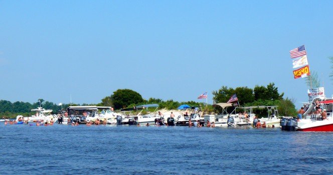
The Back Bay’s west side is more about R&R. Both the Biloxi and Tchoutacabouffa River will offer opportunities for beach breaks – it’s really just a matter of how far you want to ride or need to ride to find a patch of sand to claim as your own. Near wear both rivers meet the bay is the ever popular Grasshopper Island – party central for most weekends on the water.
Trail Tip: Make the long Back Bay crossing before noon to avoid wind and chop and grab an early lunch (while beating the crowd) for some Shed BBQ.
The ‘Goula Glades
Launch: Tucei’s Fishing Camp
Travel Distance/Time: 18 miles/26 minutes
Total Trail Miles: 77
 The Pascagoula River is a single entity that a few miles above I-10 seeks two avenues on it’s way to the Gulf of Mexico. In between the east and west branches lie miles of intersecting bayous, the occasional sandbar or beach, and trails of plenty meandering through the “‘Goula Glades.”
Travel through the P’goula drainage, is a bottom-to-top and counter-clockwise “ugly” loop. Heading north on the eastern branch you’ll find some impressive sand dunes that will make for a more than adequate stop. Just before traversing over to the western branch and heading south, you’ll have the opportunity to go north on the P’goula’s main route.
On the western branch, the trail south returns you to your starting point but the venue offers skilled riders the opportunity to test their mettle: The Whiskey & Creole combo bayous will take you off the main route, but it is so worth the fun. Taken at speed, oncoming traffic and the trees lining the route will demand your A game.
During our visit, we went “off the grid” as we explored the small, twisty bayous and sloughs that meander through the marsh. Although the occasional patch of grass and spots of low water were inevitable, we found the unmarked routes both challenging and fun. Wrapping up the ride, we finished our day at Huck’s Cove, the local burger & beer joint right on the water.
Trail Tip: Starting on the southwest end of the trail has you ending at Huck’s Cover for R & R.

The Mobile & Tensaw River Loop
Launch: Battleship Parkway Ramp
Travel Distance/Time: 65 miles/60 minutes
Total Trail Miles: 68
 Here’s yet another true loop that offers a change in scenery as well as a few historic waypoints that are certainly worth the effort.
Leaving the very north end of Mobile Bay behind, the trail goes north on the Tensaw River. The first waypoint is Gravine Island, easily ten acres of piled up sand and an easy anchorage for summertime mariners. Heading further north via Big Lizard Creek, the trail crosses the drainage to the west side where you’ll find the Mobile River just below the I-65 “Dolly Parton” bridge.
Heading south from the bridge, Big Bayou Canot will offer you a much more scenic ride, while taking you out of the way of commercial traffic. Once you make the rail bridge – the location of one of Amtrak’s worst passenger rail disasters – try to spot the track-side memorial on the east side of the bayou.
Further south, you’ll find the side trip into Chickasaw Creek and then the state port adjacent to downtown Mobile. Of interest here, you’ll cross over the I-10 tunnel while the vehicles traveling it commute nearly sixty feet below you. Finally, and saving the best for last, passage around the southern tip of Pinto Island will bring you back in Mobile Bay and alongside the mighty WWII era battleship, the USS Alabama.
Trail Tip: Pack a lunch or plan to be off the water before the crowds mass their troops at the restaurants located along Battleship Parkway.

And there you have it: Five different venues, three states, and nearly 500 miles of hydro-trails waiting to be shredded, and all within a one hour drive of Biloxi. And, if that isn’t enough, you really don’t have to look far; chances are you crossed some trails just getting to Mississippi’s Gold Coast. Here, along the Gulf’s north rim, the water never really ends and the trails go on forever…
All of these trails and others can be easily found via pwctrailfinder.com